
I’ve watched you fade away. And all that’s ever left
is a ghost of you.

Mt. 387 in Puncan, Carranglan, Nueva Ecija will break your knees. But not your heart. It is a newly-opened mountain with 2/9 difficulty level for backtrail and 4/9 for traverse.
Mia and I took a Tugegarao bound midnight bus in Cubao. We were lucky that even though it was Friday and without prior bus reservation, we were able to get seats. Our good luck however turned bad when the conductor thought that we would be alighting in Carrangalan town proper, which is 20 kms. past Puncan. Isang tumbling na lang nasa Santa Fe na kami. At 4 am, in a place we never heard of, and freezing from cold, we attempted to hitchhike with several passing trucks. We failed and realized that “trust” is the hardest thing to give nowadays. Almost two hours later, a tricyle passed at kinontrata na namin na ihatid kami sa Puncan.
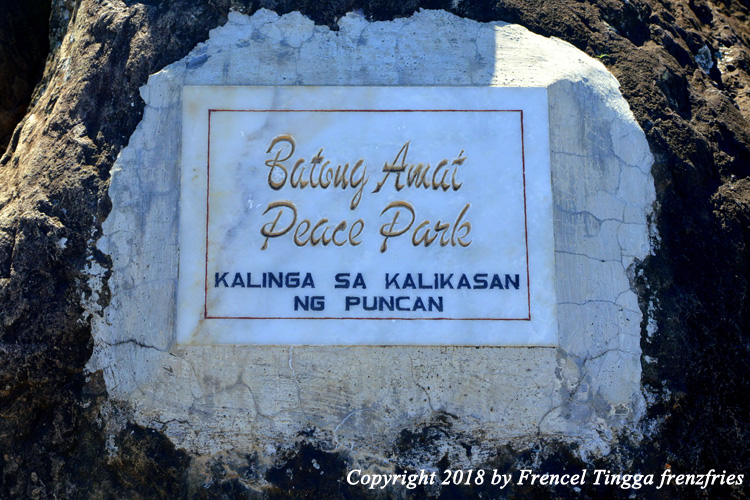
By 6 am, we arrived at Sir Roy Manuzon’s farm, the jump-off point to Mt. 387. Sir Roy is the chair of the Kalinga sa Kalikasan ng Puncan, a farmers and tour guides’ association which adopted and serves as the caretaker of the mountain. They have a Memorandum of Agreement with the Department of Environment and Natural Resources in order to protect and preserve the mountain. They officially opened Mt. 387 to mountaineers in January 2017.

Several mountaineering groups have already scaled the mountain and have hanged their tarps for bragging display.

The group of Sir Roy also serves all-day breakfast meals and even boodle fight menu for big groups. After breakfast, we had a brief orientation, where Sir Roy explained the history of the mountain and some friendly tips in climbing. So why was it named after the three digit number? The area covers 387.9 hectares of the 65,000 hectares of the Talavera Watershed Forest Reserve. The mountain is actually part of the Caraballo mountain range. I can tell that Sir Roy is really passionate in taking care and preserving the environment. In fact, he encourages mountain climbers to plant trees. They have a nursery with lots of seedlings ready to be planted.

After the orientation, we played for a while with their cute puppies. We were also introduced to Kuya Noel, our guide.

We started our ascent by 7 am. The first hour is relatively easy since it’s still a forested trail giving a lot of shade.

Pine trees are interspersed; their branches are work of nature and art. We climbed not one or two but three pine trees.


We reached the summit in less than two hours. The summit is named Batong Amat since the spot has large rocks which served as the resting place of many Filipino, American and Japanese soldiers who perished during World War II. Traces of the war is still evident on the rocks which contains many large holes caused by bomb explosions. They even found a human skeleton inside a cave. Batong Amat translates to Ghost Rock as some locals believe that the fallen soldiers’ spirits still linger in the area. It is also believed that some of General Yamashita’s treasure are hidden somewhere near the summit.


From the summit, we saw from afar a cluster of hills which many have said to resemble the Chocolate Hills of Bohol. Soft breeze blew from time to time.


Just a stone’s throw away from the summit is the famous Lovers’ Tree, the camping site with a lone, beautiful pine tree. We asked Kuya Noel why it was named after lovers; we guessed na maybe before pasyalan siya ng mga magsing-irog. He said that not so long ago, two people met for the first time on the same spot and fell in love. The couple eventually became lovers after their first meeting under the pine tree.


We slept for a few minutes under the shade of pine tree to re-charge. It was so tempting to camp overnight.
Afterwards, we proceeded to our final destination – the Aloha Falls. There are two options going to the falls. First is via backtrail, which means returning to Sir Roy’s place and from there take a truck going to the jump-off point. That’s the easy way. We took the more challenging one, which is traverse. This is the part of the trail that becomes a little steep, tricky and treacherous.


Nag slide na ako. Kumapit sa mga ugat at sanga. Nadulas. Muntik mahulog. But we made it to the flatland after two hours. There were river crossings before we finally arrived at our final destination.

When we reached Aloha, I wanted to say na napawi na sana ang pagod ko. But there were already three groups ahead of us. That’s a big crowd already. So inantay muna namin na umalis sila bago ako naligo. I lasted only for 30 seconds. I can’t stand the freezing cold waters of Aloha. But it felt invigorating afterwards.

The elf truck was waiting for us at the rendezvous point, which took us back to the base camp. It was bumpy but enjoyable ride; not advisable to pregnant women, matatagtag si baby.


After
taking our late lunch and freshening up, we bid adieu to Mt. 387; our hearts heavy
with fulfillment, and still wondering why 387.9 wasn’t properly rounded off.
From Manila, take a bus going to Tuguegarao or Isabela
(Victory Liner in Kamias, Florida Bus or Five Star in Cubao). Drop off is on
the highway leading to Mt. 387 in Puncan, Carranglan, Nueva Ecija. Nearest
landmark is the Iglesia ni Cristo church. Better take the midnight bus when planning
a day hike. No need to contact them in advance but Sir Roy’s contact nos. are 0917-5712152 or 0915-2150521.
4 comments:
May pag sstayan po ba sa place? For overnyt? Thanx
You can camp sa summit. There is also a big hut sa jump off point
If magsswim po ba sa Aloha may nearby palitan/CR?
Nung time namin wala pa cr. Just bring malong tsaka marami naman trees
Post a Comment